| Itinerary | WAY OF THE RURAL CHURCHES - Itinerary 7: Sant'Angelo del Pesco - Castel del Giudice |
|---|---|
| Region | |
| Start point | |
| Difficulty | |
| Lenght | |
| Walking time | |
| Height difference | |
| Maximum quota |
Course description
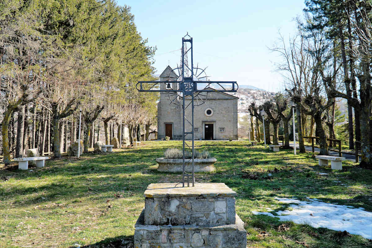
The seventh stage of the Cammino is a comfortable route characterized by slight ups and downs along a route parallel to the course of the Sangro River, which marks the border line between Molise and Abruzzo a few hundred meters further downstream. The first two kilometers of the route follow the main road connecting with nearby Castel del Giudice. However, once the asphalt is left behind, the route enters isolated places, immersing itself in unspoiled nature surrounded by small cultivations of various kinds. These include scenic expanses of apple orchards, which lend a picturesque and evocative atmosphere to the landscape. About halfway along the route, in an elevated position, we come across a small and scenic country church, the Sanctuary of the Madonna in Saletta. This place of worship offers a welcome break along the way, inviting walkers to enjoy a moment of tranquility and rest. The peaceful atmosphere that envelops the place is an ideal opportunity to recharge your energy and immerse yourself in the spirituality and beauty of the surroundings. On the way, the view opens up to pleasant vistas encompassing mountains, hills and small perched villages. The beauty and serenity of unspoiled nature accompany travelers along the way, offering an experience of deep connection with the surrounding environment. The stage, although comfortable and without significant difficulty, offers an opportunity to appreciate the tranquility and beauty of the countryside.

Useful information
Equipment and practical advice
EQUIPMENT
To optimize your equipment, carefully read information about the route to be taken and the weather and climate forecast. This could be a list of basic equipment:
backpack suitable for real needs – At least 1L of water (2 in warm months/hot drink in winter) – Hiking map – guide – sunglasses – multifunctional penknife – head flashlight – smartphone battery charger – powerbank – camera – insect repellent – first aid kit – rain jacket – airtight bag for valuables and clothing to keep dry in case of rain – bag for trash – anti inflammatory ointment – personal medication.
Bring some light and nutritious food such as dried fruits, chocolate bars, candy, honey (energy snack). Pack your lunch in advance or be sure to pass through a town in case you need supplies. Bring trekking poles that assist in pushing uphill and help with stability on rough trails. The presence of streams and wooded trails makes some trails impassable and very muddy in heavy rains. High, waterproof hiking shoes are essential here, along with good quality (breathable) socks, which should never be underestimated! Your clothing should not lack: Windbreaker/waterproof jacket; Hat; Gloves for low temperatures.
TIPS & BEHAVIOR
Although it may seem superfluous, we recall the need to behave properly and respectfully toward others and the environment, each person making his or her own contribution by bringing back with them what would harm the environment. The path can be walked all year round, but of course spring and autumn offer the best weather and landscape conditions. For many high stretches, periods of large winter snowfall should be avoided, and in the hottest summer period, water supply and travel time should be well calculated to move during the milder hours and stop during the hottest hours. The path is well marked with comfort flags and marker arrows.
Let’s not damage the plants, let’s remember that we walk through protected environments that need to be protected. We do not light fires. We keep dogs on a leash or harness, mandatory in protected areas. We do not abandon waste. We prevent all fire hazards. We also take into account that some trails may be challenging in bad weather conditions. We always follow the official trails and when in doubt turn back to the last marked trailhead. In Molise, free camping is prohibited in certain areas, therefore, facilities that can accommodate must be used.
CAI Classification of Routes
Italian Alpine Club classification of routes according to difficulty in hiking and cycling
EXCURSION SCOPE
T = Tourist
FEATURES
Routes on cart tracks, mule tracks or obvious paths that pose no uncertainties or problems of orientation, with modest inclines and moderate elevation changes.
SKILLS AND COMPETENCIES
Require basic hiking knowledge and physical fitness for walking.
EQUIPMENT
Appropriate clothing and footwear are still required.
E = Hiking
FEATURES
Routes that represent the majority of hiking routes, thus among the most varied in terms of natural environments. They take place on mule tracks, trails and sometimes tracks; on different terrain by geomorphological and vegetation context (e.g., pastures, undergrowth, debris, scree). They are generally marked and may have steep sections. Easy, unexposed rock passages can be encountered that require the use of hands for balance. Any exposed spots are usually protected. They can cross flat or shallowly sloping areas on residual snow.
SKILLS AND COMPETENCIES
They require sense of direction and hiking experience and adequate training.
EQUIPMENT
Suitable equipment with special regard to footwear is required.
EE= Experienced hikers
FEATURES
Nearly always marked routes that require ability to move along trails and tracks over impervious and/or treacherous terrain (steep and/or slippery slopes of grass, rocks or stony debris), often unstable and uneven. They may have exposed sections, traverses, ledges or rocky sections with slight technical difficulties and/or equipped, while via ferratas proper are excluded. They are developed on medium to steep slopes. Crossing sections on snow may be necessary, while all glacier routes are excluded.
SKILLS AND COMPETENCIES
Need excellent hiking experience, orienteering skills, knowledge of the characteristics of the mountain environment, sure-footedness and absence of vertigo, evaluative and decision-making skills as well as adequate physical fitness.
EQUIPMENT
Require appropriate equipment and gear for the planned itinerary.
EEA = Experienced hikers with equipment
A ferrata is defined as a route whose sections on rock are specially equipped with metal structures: cables, chains, ladders, pegs and stirrups, which facilitate and enable its progression. They provide for the use of personal protective equipment certified according to current regulations (harness, via ferrata kit and helmet) and adequate technical preparation. They are marked at the start by special signs and meet precise construction and regulatory criteria.
Points of interest
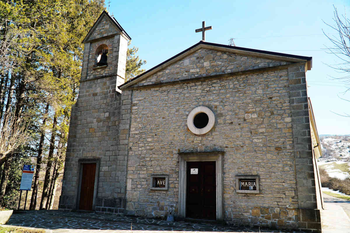
Church of Our Lady in Saletta
The small rural Romanesque-style shrine is located on the Castel Del Giudice-Sprondasino-Pescolanciano tratturello. Built probably during the Renaissance period,under the rule of the Caldora family, it was destroyed entirely during World War II and refounded and rebuilt in 1950. On the high altar is a canvas, the author of which is unknown (although popular tradition even attributes it to St. Luke) made between the 15th and 16th centuries and depicting a Madonna and Child positioned on a rock, a probable reference to the legend related to the founding of the place. There are two hypotheses regarding the foundation and dedication of the site: the first can be traced to the ancient inscription found at the site that reads ‘Salectu Ubi Ex Antiquitus Ficta Fuit Columna Marmorea,’ suggesting that the church was built where a marble column once stood.
The second hypothesis, based on folk tradition, is also linked to the destruction of the village, once located right where the ‘Saletta’ pond stands today, just a few steps from the small church. Tradition has it that the Virgin, who appeared in the village as a maiden with child, tried in vain to receive hospitality from the inhabitants of Castel Del Giudice, who were intent on wheat harvesting operations. Not being accepted, the country would be hit by divine retribution in the form of a flood. The Virgin would sit on a rock, become soft, and be undermined by the devil in the form of a snake. The stone would still bear the marks of this history. Our Lady would then continue on her way, stopping right where the shrine stands today. Remains of dwellings, perhaps of a monastic site, and human remains of worshippers who decided to be buried at the place of great devotion have been found around the shrine. Again, popular tradition tells of the attempted theft of the canvas by the nearby inhabitants of Capracotta and its miraculous return to the small church.
Church of Our Lady of Mount Carmel
The church of Sant’Angelo del Pesco dedicated to Our Lady of Mount Carmel is located at the end of the row of houses on either side of Via Madonna and near the driveway leading to the cemetery. Of 18th-century construction, it also originally served a cemetery function. It became the headquarters of the Confraternity of Carmel in 1848, which has administered it ever since.
In 1863 a fire caused by lightning caused extensive damage to the church, destroying the image of Our Lady of Mount Carmel. The Confraternity then commissioned the Apulian artist Biagio Molinaro to create a new painting. The artist, active in Rome and Naples, made the valuable canvas depicting, the Blessed Virgin of Mount Carmel, in Sant’Angelo also venerated as Our Lady of the Assumption, in the act of handing the scapular to St. Charles Borromeo, flanked by St. Francis de Sales. The townspeople recently took action to proceed with the restoration of the precious painting, which the people of Santangiolo are very fond of. The church, in particular, represented a refuge for the townspeople during the Second World War and at the end of the latter, from which the town emerged completely destroyed.
3D Map
The linked App is not related to the website, but provides additional convenience in using the presented content. Its use is voluntary. If the app is not yet installed on your device, you will be redirected to the corresponding App Store.
Sant’Angelo del Pesco – Castel del Giudice
(km 4.43)
Itinerary 7
Departure: Sant’Angelo del Pesco
Arrival: Castel del Giudice
Distance: 4.43 kilometers
Walking time: 1h 20′
Difficulty: Tourist
Height difference: +200 -200
65% asphalt – 35% dirt roads
Cyclability: Yes – presence of short sections with steep gradient
Recommended Period: Spring, summer, autumn
GPX files: Download
![]()
![]()
![]()
![]()
Frame or click the QR code and open the Web App

It should be noted that the routes may include sections where vehicular traffic is concurrent.
Photographs
Other Itineraries
![]() I1: Civitanova del Sannio – Poggio Sannita
I1: Civitanova del Sannio – Poggio Sannita![]() I2: Poggio Sannita – Belmonte del Sannio
I2: Poggio Sannita – Belmonte del Sannio![]() I3: Belmonte del Sannio – Agnone
I3: Belmonte del Sannio – Agnone![]() I4: Agnone – Capracotta
I4: Agnone – Capracotta![]() I5: Capracotta – Pescopennataro
I5: Capracotta – Pescopennataro![]() I6: Pescopennataro – Sant’Angelo del Pesco
I6: Pescopennataro – Sant’Angelo del Pesco![]() I7: Sant’Angelo del Pesco – Castel del Giudice
I7: Sant’Angelo del Pesco – Castel del Giudice![]() I8: Castel del Giudice – Capracotta
I8: Castel del Giudice – Capracotta![]() I9: Poggio Sannita – Castelverrino
I9: Poggio Sannita – Castelverrino![]() I10: Castelverrino – Agnone
I10: Castelverrino – Agnone
Highlights
Some sections of the Way are impassable due to dense vegetation.
Routes No. 7, Sant'Angelo del Pesco – Castel del Giudice, and No. 9, Poggio Sannita – Castelverrino, are currently impassable due to the very lush vegetation that prevents travel along large sections. Other routes: No. 2 POGGIO SANNITA – BELMONTE DEL SANNIO, No. 3...
The itineraries of the Country Churches Trail are also available on the Strava platform.
From 30 September, the 10 itineraries of the Country Churches Trail will also be available on Strava, one of the leading fitness apps. a5> will also be available on Strava, one of the leading digital platforms for outdoor enthusiasts. Strava, www.strava.com, is the...
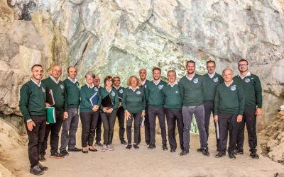
Concert by the CAI Choir of Lanciano in the Cloister of San Francesco di Agnone
AgnonEstate 2024 Appointments. On Friday, August 2 , at 9:30 p.m., in the beautiful setting of the Cloister of San Francesco, the Italian Alpine Club (CAI) Choir of Lanciano will perform a brilliant and sophisticated repertoire betweenclassic Alpine songs and Abruzzo...

The “Walk of the Country Churches” is an outdoor trail of about 90 kilometers connecting 9 historical centers e 15 small churches scattered throughout the territory of Agnone, Belmonte del Sannio , Capracotta , Castel del Giudice, Castelverrino, Civitanova del Sannio, Pescopennataro, Poggio Sannita e Sant’Angelo del Pesco.
© The Way Of The Country Churches | Project | Credit | Privacy Policy | Cookie Policy | Contact
INITIATIVE FUNDED BY THE FEASR – European Agricultural Fund for Rural Development – PSR Molise Region 2014 – 2020


